UN
8 Thomas Drive
£ 278,000
Description
We don't have a Description for this property.
- Bedrooms
- 2
- Bathrooms
- 0
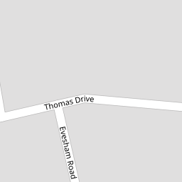


Leaflet © OpenStreetMap contributors
The heatmap indicates the level of crime in the area. The color of the heatmap indicates the crime severity and recency.
Metrics Year-on-Year
- Average area value
- 429,091.00 £Increased by 6.94 %
- Average area rental value
- 1,890.00 £/moIncreased by 23.93 %
- Est rental Yield
- 5.29 %Increased by 16.01 %
- Crime Rate
- 5.00 %Unchanged by 0.00 %
from 401,250.00 £
from 1,525.00 £/mo
from 4.56 %
from 5.00 %
Nearby Schools
| Name | Type | Ofsted | Distance |
|---|---|---|---|
| St John'S Catholic Comprehensive | Voluntary Aided School | Good | 0.70 KM |
| North West Kent Alternative Provision Service | Academy Alternative Provision Sponsor Led | 0.97 KM | |
| Kings Farm Children'S Centre | Children's Centre | 1.00 KM | |
| St John'S Catholic Primary School, Gravesend | Academy Converter | Good | 1.00 KM |
| Gravesend Grammar School | Academy Converter | Outstanding | 1.00 KM |
Images
Nearby Streets
| Name | Average Price | Average Sqft | Distance |
|---|---|---|---|
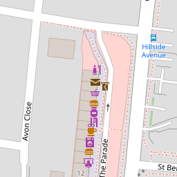
| Hillside Avenue | £ 350,000 | 0 | 0.00 KM |
| The Parade | £ 0 | 0 | 0.00 KM |
| Arnold Road | £ 475,000 | 0 | 0.00 KM |
| Bristol Road | £ 410,000 | 0 | 0.00 KM |
| Saint Dunstan's Drive | £ 375,000 | 0 | 0.00 KM |
Nearby Transport
| Name | NLC | TLC | Distance |
|---|---|---|---|
| Gravesend | 5172 | GRV | 2.40 KM |
| Tilbury Town | 7462 | TIL | 5.03 KM |
| Sole Street | 5126 | SOR | 5.04 KM |
| Meopham | 5116 | MEP | 5.50 KM |
| Northfleet | 5120 | NFL | 6.86 KM |
Nearby Listings
| Address | Price | Type | Score | Distance |
|---|---|---|---|---|
| Thomas Drive, Gravesend, Kent, DA12 | £ 450,000 | BUY | 7 / 10 | 0.01 KM |
| Thomas Drive, Gravesend, Kent | £ 500,000 | BUY | 8 / 10 | 0.10 KM |
| Hillside Avenue, Gravesend, Kent, DA12 | £ 350,000 | BUY | 6 / 10 | 0.12 KM |
| Hillside Avenue, Gravesend, Kent | £ 350,000 | BUY | 7 / 10 | 0.15 KM |
| Winchester Crescent, Gravesend, Kent, DA12 | £ 375,000 | BUY | 7 / 10 | 0.15 KM |
Nearby Properties
| Address | Price | Distance |
|---|---|---|
| 30 Thomas Drive | £ 335,000 | 0.00 KM |
| 26 Thomas Drive | £ 155,000 | 0.00 KM |
| 8 Thomas Drive | £ 278,000 | 0.00 KM |
| 36 Thomas Drive | £ 155,000 | 0.00 KM |
| 20 Thomas Drive | £ 265,000 | 0.01 KM |